Join our our Open-Source Platform: https://links-ads.github.io/projects/safers/
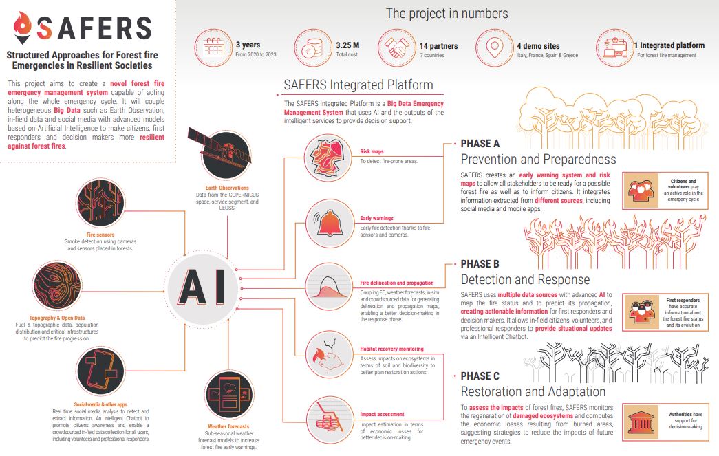
SAFERS designed and implemented an integrated platform that uses information from different sources: earth observations from Copernicus, fire sensors in forests, topographic data, weather forecasts and even crowdsourced data from social media and other apps that can be used by citizens and first responders to provide situational in-field information.
The SAFERS platform is based on two main subsystems: A web-based dashboard and a Geodata Repository & Importer and Mapper.
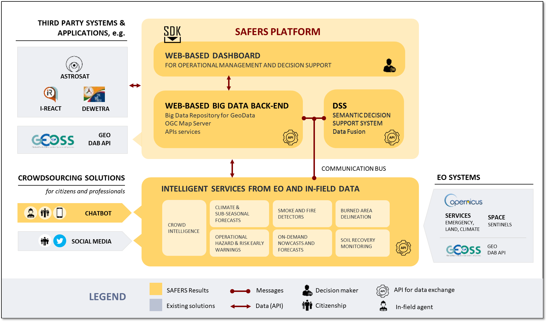
SAFERS platform is able to integrate all the following Intelligent Services, serving as the main touchpoint towards the end-users.